Educators engage in professional learning.
Over the past 12 months, I have been able to attend a wide range of professional development seminars and workshops through online conferencing. Sometimes these professional developments are focused on relaying some kind of product, method, or idea, and other times they are focused on discussion, both open and directed. There are many professional development experiences that are worthy of mention; however, I have chosen to highlight a digital tool from one of my favourite workshops and how I see it as a brilliant tool for place-based learning: The iNaturalist App.
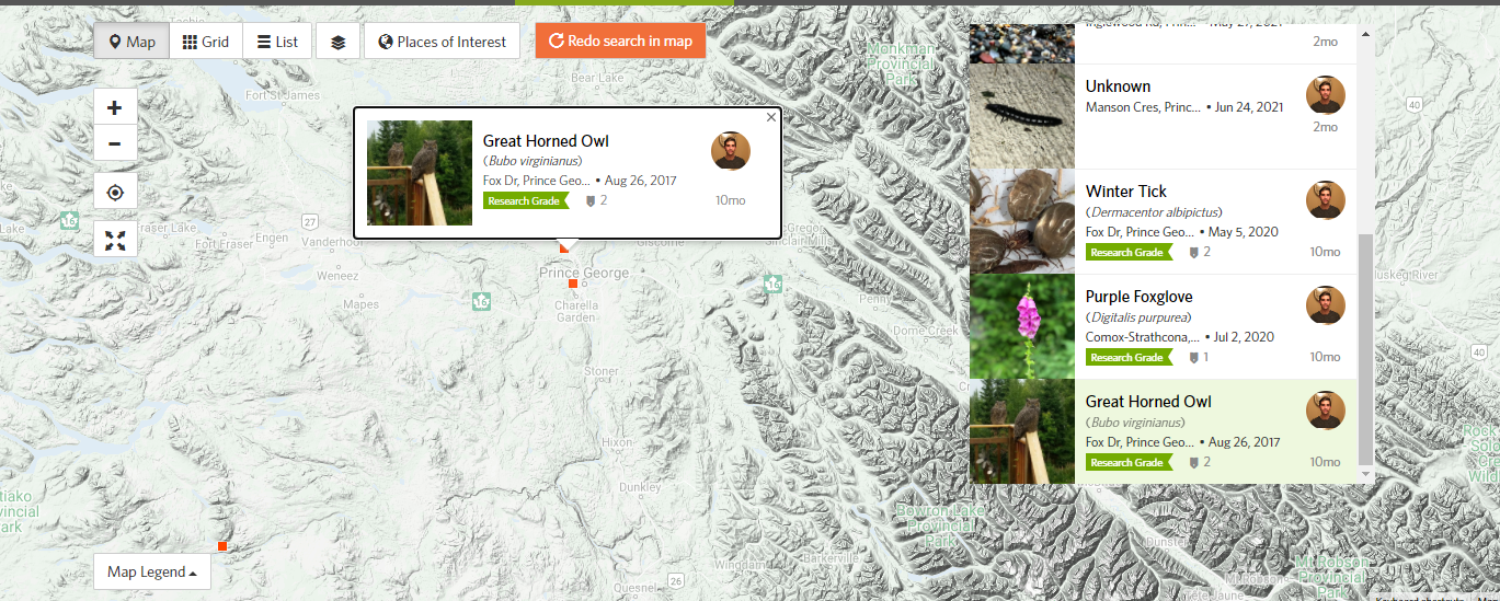
Using the iNaturalist app in and out of the classroom
In the Exploring Nature with iNaturalist workshop, presenter Neil McCallum introduced the participants to the iNaturalist app which was developed by a Masters student from UC Berkley and uses image recognition software (like the automated categorization of your Google or Apple images for example) to identify taxonomy in nature. This free app allows the user to observe and identify organisms in nature to a degree of precision that reflects the quality of the image or audio input. The uploaded file is then cross referenced to a databased, geotagged, and stored on a public database. Geotagged identification is mapped for public access where any user can add additional input, corrections, confirmations, collaborations, and more. The data is also publicly available with defined quality parameters so it may be collected and utilized by researchers. For the classroom, a teacher can create a class account and have students perform and participate in projects while keeping their online anonymity; moreover, the geotag option allows the precise location to become generalized to prevent tags from marking student’s homes. There are many teaching resources available as well, including the City Nature Challenge and the BC Nature Challenge & BC Parks iNaturalist Project. For teachers looking to utilize iNaturalist with younger students (Grade 3 and under), there is another free app by iNaturalist called Seek, although I have not given this one a try. I have been enjoying playing with app and uploading my own images. I was also impressed to have received multiple responses from hobbyists and professionals in the community regarding my uploads. Furthermore, I was blown away by the apparent number of users found all over the globe while I used the interactive map portion called ‘Explore’. The potential to use this tool, such that the identification of local species becomes accessible to all, as wide ranging possibilities for place-based learning, including identification of native and introduced species, identification of rare species in different regions, identification of edible or medicinal species, and more.